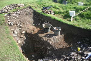
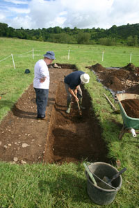
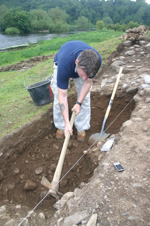
Day 19 – It is all becoming clear now…
First of all, the piece that RTE came to the site to film was aired on the 6-One News and the 9 O’Clock News on RTE1 last night. It is amazing how much time was spent on-site and how much footage was shot to make up the final piece. I think the point was well made, however and thanks to Chris in the Institute of Archaeologists of Ireland (IAI) for setting up the piece and to Philip Bromwell for his interest and patience. For those who didn’t see the piece, the link is:
http://www.rte.ie/news/av/2011/0727/media-3012820.html
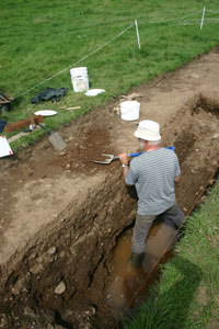
Anyway, back to business at Rossnaree. There was prolonged rain overnight which thankfully had cleared by morning. This moisture did wonders in each of the cuttings because suddenly there was, once again, some colour in the soils. Instead of a continuous hard-packed dusty pale yellow surface like concrete, we could see all shades of brown, orange, yellow and even red. At last we had some clarity and we able to distinguish between the last skims of ploughsoil and the undisturbed natural. If only this had happened a week ago it would have been much more helpful, especially in Cuttings 7 and 8 where had such difficulty. That’s the way the breaks come – all real discoveries inevitably seem to come in the final week of the dig (remember what happened last year!) or, worse in the last day or two.
Sieezing the opportunity presented by the conditions, Darren, Sophie and Ciara trowelled over the surface of Cutting 8 one last time to reveal a number of disturbed areas which are probably the remains of additional graves in the cemetery. At this late stage of the dig it is not feasible to excavate further but we at least have been able to identify and record the location accurately. All of the new detail was added to a plan of the cutting later on that afternoon.
In Cutting 7 we were joined by Rossnaree veteran Kieran Campbell who was a member of the team from last season. Kieran very kindly offered to help out in the last few days of the dig – exactly the time when he is needed most. Kieran undertook to lift the skeleton in Burial 2 along with Matt. Mags recorded a number of the features that Matt had previously examined in the cutting by drawing sections and profiles of them. Matt later finished drawing the post-excavation plan of the cutting and he added the detail of the grave cuts. When this was done he drew up the southern section face of the cutting showing the depth of ploughsoil and the various levels within it. Kevin was also on hand again today and using a total station he accurately recorded the positions of the control points we had installed around Burial 2. He also surveyed in the location and shape of each of the grave cuts of Burials 1 and 2.
In Cutting 6 Eimear carried out post-excavation plans of the two completed sections and also drew up the profiles of the sides of the cuttings. Niamh continued to excavate a section through the oval enclosure ditch and this is turning out to be quite a substantial feature. It is a lot deeper and wider than we had anticipated but she has found the edges on either side as well as the base. Very good work for one day.
Tomorrow, we will finish the last of the recording and then start the backfilling. I’ll let you know how we get on.
Day 16 – The pressure’s on.
We are now into the final week and there seems like so much still to be done. At least the weather is holding up. It was not as sunny as it was over the week end – the day started out a bit overcast with a few drops of rain as well, but very calm. As the day wore on the cloud cover thinned and although the sun didn’t come out fully it was quite a warm and pleasant day.
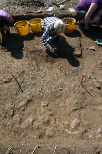
In Cutting 7 Lisa and Ciara continued the final clean-down of the surface to make absolutely sure that there are no further features there. Matt started work on lifting a piece of cranium we had noticed on Friday in the south west corner of the cutting, a little distance away from the grave cut. We had assumed that this was a fragment of bone disturbed from another grave but as Matt cleared more it became apparent that there were several pieces of bone in situ within the fill of yet another grave cut. This, of course, is not surprising because we already have found one grave, but it is not something we had planned, or hoped, to find. The work in this area will now slow down again considerably as the grave is carefully excavated and recorded. This is time we can’t really afford at this late stage.
.
.
.
.
.
.
.
.
.
.
.
.
.
.
.
.
.
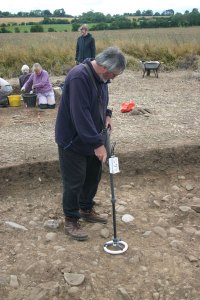
In Cutting 6 Eimear and Darren continued work on their respective sections and both were successful today in finding the western edges of the cut. In each case the edge was cut into quite gravelly material, very similar to that identified in the base of the ditches excavated last year. Ash, animal bone and charcoal are all frequent and at Darren’s end, there seems to be a lot of flint while at Eimear’s end there is an interesting socketed iron object, probably a tool of some sort, sticking out of one of the layers. Kevin had identified this as a location of some potential last week when he scanned the cutting surface with his metal detector. The next step is to identify the various fills visible in the vertical section face of each mini-cut and then to photograph and draw them up.
In other news, we had a visitor today from RTE television – Philip Bromwell – who is doing a piece on how the archaeological profession in Ireland is faring in the current recession. This was a suggestion made by the professional body for archaeologists in Ireland, the Institute of Archaeologists of Ireland (IAI). As well as filming the dig in progress and speaking about the stages in the research process leading up to the excavation, there was discussion of the many archaeologists who had been working in the profession who are now unemployed. There was also some talk about the severe cuts in various research funds available for archaeological research like the Heritage Council’s discontinued Heritage Research grants or the INSTAR grants. The piece will hopefully air on the 6 One News later this week. I’ll let you know…!
Day 15 – Summer’s back!
Well, who’d have thought it? Met Eireann, the Irish weather service issued an apology for the weather forecast for yesterday. They said there’d be occasional showers in the east of the country (where the Rossnaree excavation is located) but instead there was virtually continuous grey wet drizzle for much of the day. You have to take the rough with the smooth – normally when the forecast suggests that there might be showers or rain, I have found that we have a good chance of being lucky. The rain takes a little bit longer to get across the country to us in Rossnaree and we usually seem to escape the worst of it. To have the opposite happen once is, I think, acceptable because of the number of escapes we have had over the last few weeks.
.
.
.
.
.
.
.
The weather on-site was perfect – bright spells and cloud, not too hot, and no rain of any sort. Everyone was in a good mood (I think) and there was an air of quiet industry over the site for much of the day. Ciara was working single-handedly in Cutting 7 for the morning giving one last clean-back to the exposed surface there to make sure that no possible features had been missed. After lunch, Matt did a plan of the grave again, detailing the position of each of the bones and we spent the afternoon excavating, lifting and carefully packaging each bone. Each piece was numbered on the plan and photographed and wrapped and labelled for storage and later study.
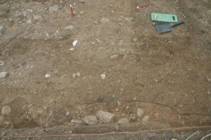
Mags and Sophie continued to take down the last of the disturbed layer of soil overlying natural in Cutting 8. Despite the rain the previous day, the soil was drying out very quickly making the identification of the different colours difficult. The layer closest to natural has quite a mottled appearance – it is a mix between the compact yellowish natural and ploughsoil and has frequent worm holes through it. There are still occasional flecks of charcoal and occasional fragments of bone so we are certain that the surface is definitely not natural. Hopefully we will be finished in this cutting very soon.
.
.
.
.
.
.
.
.
.
.
.
In Cutting 6 Eimear continued to dig the section at the southern end of the cutting and a number of interesting finds came up. Below the upper layer of charcoal rich soil there is a thick deposit of almost pure ash and within this there is a deposit of animal bone, probably cow, including a mandible (jaw) and rib, among others. These seem to have been deliberately deposited with a number of burnt stones (one of which Eimear named ‘the raspberry stone’ because of it’s vivid colour!) and also an intact bone needle/pin. This is definitely find of the week and although it can’t be closely dated, it definitely belongs to the early medieval period. The Neolithic remains elusive.
We set Darren up at the northern end of the cutting doing a similar section to Eimear across the ditch. We seem to have clear edges to the ditch feature with natural visible on both sides. Again, the fill is very rich in charcoal and ash and the edge of the cut of the ditch is quite steep. There was still no sign of the base of the ditch cut in the evening when we were finishing up. Flint artefacts were frequent but it is not clear whether they are indicating a date for the digging of the ditch or whether they were disturbed and incorporated into the fill of the ditch during the early medieval period. Lots to look forward to on Monday.
Day 13 – Putting our best foot forward.
Work continued from yesterday with Eimear planning in Area 1 (Cutting 6), Matt excavating features in Area 2 (Cutting 7), Niamh extending the cutting to expose the full extent of the grave cut, and the rest of the team taking down the rest of the base of ploughsoil material in Cutting 8. Kevin, our geophysical surveyor, was also on site again to monitor progress, compare the excavated features to the anomalies identified in the initial surveys and take some additional readings.
.
.
.
.
.
.
.
.
In Area 1, Cutting 6, Eimear’s plan is nearing completion. The process is taking some time because of the size of the cutting and the complexity of the features and soils there. However, she is nearly finished and we will be taking levels on the surface tomorrow morning and assigning numbers to each of the separate fills and features. We even made a start this afternoon on one spread of material that seems to be occupation/refuse spread associated with the occupation of the oval enclosure. This appears to overlie the lower north-south ditch fill so we set Igor up to put a section across it to assess its depth. By tomorrow we will hopefully know what its exact relationship is to the other features and fills around it.
Matt continued to deal with other features in Cutting 7 while Niamh and Sarah excavated the 1m x 0.5m extension to the cutting to fully open up the grave cut. His feature today, numbered F.705, appeared on the surface as a spread of charcoal flecked soil extending over an area c.1m in extent and disappearing beneath the northern baulk. As Matt excavated the feature revealed itself to be small furnace with a number of heat-shattered stones around and in it. The fill is mainly charcoal-rich soil, which we sampled. There was also a stone with a distinct concretion suggestive of some sort of slag, waste material from an industrial process, possibly metalworking. The base of the feature was reddened, baked soil, indicating intense heat. The proximity of this feature to the grave is interesting as it is not unusual to have such industrial features close to burials on non-ecclesiastical sites. Niamh, Sarah and Ciara gradually removed all of the ploughsoil from the extension and revealed the line of the grave cut retrieving a fragment of cranium from the ploughsoil Matt then added this detail to the previously drawn plan and proceeded to tidy up the area and continue to excavate it.
.
.
.
.
.
.
.
In Cutting 8 the team there continued to remove, using trowels, the base of ploughsoil/interface layer. At the southern end of the cutting Igor had recovered a number of pieces of human bone and a tooth which indicates that there were probably other graves in that area which are now destroyed by ploughing. There is also a small gully-like feature here which appears to be relatively late in date and may be associated with later agricultural activity. Also at the southern end of the cutting, Lisa found her first feature. It looks at this stage like a very nice post-hole – an area of loose darker soil surrounded by a ring of packing stones. We will take a closer look at it in due course.
Kevin was on hand again to look at how work was progressing. He took additional magnetic susceptibility readings from the excavated surfaces of each of the cuttings and recorded interesting results. The values were all significantly higher than those recorded at the surface prior to excavation. There will be a very useful dataset gathered by the end of the excavation to carry out detailed comparisons between pre-excavation surface readings and post excavation readings as well as surface soil samples and ‘top of archaeology’ soil samples. Kevin also took the opportunity to scan the spoil heaps with a metal detector to ensure that we hadn’t missed anything (I don’t think we have but you never know..!) and he also scanned the unexcavated surfaces around the cuttings. In the afternoon, Kevin used a total station to survey in some of the major features identified on the site so far like the grave cut and the edges of the ditches in Area 1 Cutting 6.
In the afternoon we had a bit of diversion when the group of students currently working a the Blackfriary site in Trim paid us a visit. They are part of the Irish Archaeological Field School and on their way they visited the Bective site. I think the students enjoyed their visit and they told us that it was quite different to the other two sites.
Day 12 – Them bones, them bones…
Today was cold but dry. There was a wind from the north west for much of the day which meant that most people on site kept their coats on all day. A wooly hat even appeared – I’m not naming any names. Thankfully, the day remained dry and we were able to get a lot of work done again.
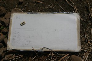
Eimear continued planning Cutting 6 and was assisted at different times by Lisa and Ciara who were introduced to the system of drawing archaeological plans, measured to scale. It is a big cutting and this work took the whole day. It will be finished tomorrow and we will then number all of the separate features and fills that are visible and take levels on the excavated surface.
.
.
In Cutting 8, the team finished taking down the last of the ploughsoil and then began to trowel back the surface. As predicted, this was a lot easier and quicker to carry out than in either Cutting 6 or Cutting 7 because we are now so familiar with the depth to natural and the appearance of the subsoil.
.
.
.
In Cutting 7, Matt continued to examine the various features that were identified. Some of these are a lot less substantial than they seemed on the surface as they might only be the very deepest traces of largely destroyed features remaining below the level of the ploughsoil. Nonetheless, some are still promising.
.
.
.
.
The ‘mystery feature’ I mentioned yesterday has been confirmed as a grave cut with a number of human bones in it. This was identified for us today by Laureen Buckley, Ireland’s foremost osteologist (specialising in the study of human bones from archaeological sites). We were given instructions as to how to go about excavating and lifting the bones which are in poor condition and quite fragile. We will also need to extend the cutting to expose the full length of the grave and recover all of the bones.
.
The burial was quite disturbed by previous activity on the site including ploughing and the bones had been moved from their original positions within the grave cut. This work will take some time because the bones are so fragile and every care must be taken to ensure that the job is done correctly. We were all very lucky that Laureen kindly gave a short talk to the team about recognising and dealing with human remains on an archaeological site. I think I learned as much as the volunteers.
Day 11 – A new week.
We’re over the half-way mark now and beginning to think about making sure we are able to finish everything we start in the time available. We were joined by a new person this morning for a few days – Igor – who was involved in the geophysical surveys of each of the areas immediately prior to the start of the excavation. While Igor now works mainly in geophysical surveying, he has spent time on a number of the Celtic Tiger road schemes and his experience is welcome.
.
The weather over the week-end had been quite mixed with a lot of showers. This was good for the site because when we arrived down and took a closer look at the cuttings, the additional moisture in the soil has made it a bit easier to see the differences in the colours and textures of the soils making up the fills of features. In Area 2 Matt continued to examine features that were identified and planned last week. He did this by half-sectioning them. This is where half of the feature is excavated using a trowel or a leaf trowel to find the exact extent and the cut and base of the feature before excavating and removing the second half. This usually means that the excavation of the second half of the feature is more accurate and ensures that any soil samples, which are only taken at this stage, are less likely to be contaminated with other soils. These soil samples can later be processed to identify macrofossil remains, i.e., fragments of vegetation etc. which, in turn, can tell us about the environment around the site at the time the feature was in use.
Most of the features that we had identified turned out to be less than exciting. Many seem to be pockets of soil that had accumulated in deeper-than-usual hollows left in the subsoil where large cobbles were disturbed by ploughing. However, there is one area where there may be a substantial feature containing a number of fragments of bone. We have labelled this Feature 714 and we will take a closer look tomorrow before coming to any conclusions. I’ll keep you posted.
Darren and Sophie continued to take down the ploughsoil in Cutting 8 and this was almost completed by finishing up time after a burst of very robust mattocking by Igor. Once the cutting clear, we will work it back again to find the base of ploughsoil in the same way as we did in the other cuttings. However, this process should be a lot quicker this time because we have a very good feel for what the local subsoil looks like and at what depth we should expect to find it.
.
.
.
.
.
.
.
In Area 1 the cleanback continued in preparation for photographs and planning. The whole surface of the cutting had to be troweled over lightly again because a certain amount of dust and other debris had blown in over the week-end and the rain had made the surface less clear and distinct. Eimear was in charge and by the afternoon, the photos were taken and the planning could begin.
Day 10 – A lot done, a lot more to do!
We’re now officially half way through the excavation and as the title suggests, we have achieved a lot so far and we hope that there will be much more to discover before the end. The weather forecast for today was not at all promising, with prolonged and heavy showers predicted. However, once again, we had an uninterrupted day on site although there were a few short showers in the afternoon.
The big excitement of the day was the visit of the man from LMFM, Pat O’Shaughnessy with the station’s outside broadcast unit. Pat visited the site and interviewed the Director (myself!) which was broadcast live on the Daire Nelson Show. It is nice to get the support and have an opportunity to let people know a bit about what is going on on the site.
.
.
.
Good progress was made on the site today as well. Eimear went over to ‘The Far Side’ from where she was in Area 2 and really began to make inroads into understanding what is going on in Area 1. With her help, Lisa, Sophie and Mags completed the clean-back of the cutting and identified a number of possible features and, better still, were able to locate the edges of some of them. The next step is to photograph and plan the cutting before beginning to excavate.
.
.
.
.
.
.
.
In Area 2 Matt continued to plan the cutting there and Tomás, Jamie and Sophie all had a go at planning with the planning frame. It is a tricky task when you are a beginner but all three picked up the idea quickly. They were feeling the effects of the ‘crouched over’ stance at the end of each of their turns, however. Once the plan was complete, the next step was to add levels and Tomás and Darren between them took on the task. When this was over, Matt and myself took a close look at the cleaned surface to identify where exactly we think there are features. No less than ten features were identified and these were numbered separately and added to the plan. Matt then started to excavate one of them – the first ‘real’ archaeological feature to be excavated on the site. It turned out to be a stake-hole with evidence of the stake having rotted in situ. We have no idea when it dates from, unfortunately.
.
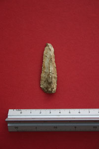
Tomás, Darren, Jamie and Sophie worked away on the new cutting and made excellent progress. Apart from flint tools, they found a few strange finds in the sieve and some of them are shown here.
.
.
.
.
.
.
It was unfortunately the last day for Tomás and Jamie today and after we had packed up there were fond farewells before we all went our separate ways for the week-end. A big thank-you to them both for their unfailingly good-humoured work on-site. I hope they both found the experience interesting and worthwhile.
Day 8 – What a scorcher!
Today the weather was fantastic – one of the best days on site so far. Sun hats and sunblock were very much in evidence all day. Mind you, if you think we were happy about this, think again. The hot weather was causing difficulties for the archaeology. As soon as an area is freshly troweled, it dries out and becomes a grey-brown mass of crumbs. Elsewhere, in the untroweled areas, the surface is becoming baked to the consistency of concrete. We’re never 100% happy with our lot – there’s always something to give out about!
.
.
.
.
.
In Area 1 the work continued taking off the last layer of ploughsoil in an attempt to reveal and recognise intact archaeological features as indicated on the magnetic gradiometry plot. Ciara came over from Area 2 to help out and was glad to get away from sieve duty there for a change. As outlined already, conditions were difficult and presented a bit of a challenge to the novice trowelers. It is a slow and sometimes frustrating task, especially when you are unsure of what exactly it is you are looking for. The dry conditions don’t help, making it even more difficult to keep your area clean. Troweling is an activity that takes some degree of concentration. The troweler needs to work very methodically, removing a thin layer of soil from your area and leaving the surface clean and ‘fresh’ so that the texture and colour is visible or at least discernible. When troweling, the excavator needs to be constantly asking questions of the soil in front of them – is this area different to that one? If so, how is it different. Is it the colour of the soil, the texture, its stoniness, the inclusions? If there is a diffrence, where is the junction? is it a clear line or a gradual transition? All of this goes towards understanding what features are present on a site and contributes towards their accurate description and recording. It is not an activity where you can just ‘switch off’. You need to be constantly thinking.
Anyway, we made good headway in Area 1 and despite the dry conditions were able to start recognising different features and some of the edges between them. An additional bonus was that these seem to match up well with the anomalies identified by the magnetic gradiometry plot. It seems that we are on the right track here.
In Area 2 the story is a bit different. They continued to take down the material we are calling ‘base of ploughsoil’. Already the cutting is over 50cm deep, which is about 15cm to 20cm deeper than Area 1. Even at that level, in areas that yesterday were looking like undisturbed ‘natural’ or subsoil, there are fragments of animal bone and flecks of charcoal indicating that the soil is, in fact, disturbed. We may have a situation in this area where there are no defineable features but rather the remains of a spread of occupation material lodged in between and just above the cobbles of the intact natural.
Hopefully, the situation will be clarified tomorrow…
Day 7 – Those wascally wabbits
Our nocturnal visitors had been back again to the site and this time they seem to have tried to set up residence in the Area 1 spoil heap. When we arrived down to the site this morning there were several burrows dug into the heap with a series of cute little footprints all around. They seem to have given up, however, as the holes weren’t too deep and were apparently unoccupied. As long as they confine themselves to the spoil heap I don’t mind too much – on some other sites I have dug on rabbit burrows had done a lot of damage to the archaeology. For some reason they don’t seem to be interested in the Area 2 spoil heaps.
On the work front the last of the ploughsoil was taken down – two half squares and one full square. This was easily achieved before the morning break and there was a certain air of proud satisfaction at the final moment. 30 square metres of ploughsoil removed and sieved since the start of the dig. After the break we took a second series of magnetic susceptibility samples from the base of ploughsoil using plastic implements in order to reduce the possibility of contamination. One sample was taken from each metre square and duly brought up to the cabin at lunch time. Once this was done we were ready to start troweling the surface to remove the last skim of ploughsoil and start identifying the features. Working from east to west in column I squares 1-5, we uncovered a band of hard, compact, yellowish soil which gradually gave way to darker slightly less compact, more fill-like soil with frequent flecks and larger pieces of charcoal and animal bone, also with occasional pieces of flint. This looks like the top of the fill of the north-south ditch identified in the geophysics. We will continue tomorrow and see what emerges.
In Area 2 Matt, Tomás and Ciara continued to take down the last skim of ploughsoil using a combination of troweling and mattocking. As described yesterday, a number of possible features had been identified yesterday along the northern side of the cutting. However, there were no similar features visible elsewhere in the cutting that might correspond the the geophysical anomalies. Matt carried out a sondage, or test area, in the extreme southwest corner of the trench to determine exactly where subsoil was located and it emerged that there was another 10 to 15cm to be taken down. Thus, although the northern edge was relatively clear, there seems to be a shallow wedge of ploughsoil thickening towards the southern side of the cutting. There is usually an occasionally disturbed zone at the very base of the ploughsoil which is transitional between fully disturbed ploughsoil and never disturbed natural/subsoil with archaeological features. When ploughing takes place in a field, it doesnt necessarily plough to exactly the same depth as previous years with the result that there is no clear ‘line’ or interface between ploughsoil and ‘unploughed’ soil. Sometimes, depending on local soils, it is difficult to easily distinguish between regularly ploughed ploughsoil, occasionally ploughed base of ploughsoil and subsoil and it takes a bit of deliberation to establish where each ends and the next begins. Tomorrow they will remove this and trowel the surface back and hopefully we will see some more features.
Day 6 – Moving up a gear.
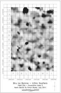
We all arrived down to the site hut revitalised, reinvigorated and ready for the new week. We were close to being completely free of the monotony of mattocking, shoveling and sieving through ploughsoil, although the finds we are coming across are nice. In Area 1 at the start of the day there were still 10 square metres to be dug away and throughout the day the team there got through seven and two half squares. Tomorrow, there are only two half-squares and one full one to go. Once they are gone, we will be nearly ready to begin to search for the features identified in the geophysical surveys carried out by Kevin before the dig started up. In the plot the cutting itself is made up of columns G, H and I and extends from row 1 to row 10. This takes in two very distinct features: one, a possible ditch running from north to south (from previous geophysical surveys this seems to be the innermost enclosure defining the knoll of high ground) and the second, at a higher level and cutting the other feature curving in from the middle of the right side to the bottom of the panel (this seems to be a separate oval enclosure superimposed on the other ditch. See the original plot HERE). This cutting will investigate the exact relationship between these two separate features and hopefully will yield material for dating.
.
.
.
.
.
.
.
.
In Area 2, they started the day with just two metre squares to go and these were quickly removed and sieved. Once this was completed, we took another series of soil samples for lab magnetic susceptibility measurements using the same grid as before. Thus we will be able to compare values taken from the field surface to those at the base of ploughsoil. Once this was done the cutting was ready to be troweled back. There was still a layer of ploughsoil over the cutting – we deliberately didn’t remove everything when we were mattocking off the ploughsoil partly to protect the site from being open too long and from the impact of people crossing over and back as they work. Trowelling, with the help of some light mattocking where necessary, is the next step taken to remove any remaining layer of disturbed ploughsoil and begin to identify the features underneath. We are lucky in that we have a very detailed set of geophysical plots to guide us as to what to expect. However, the picture here is less clear with a series of features that are unfortunately less identifiable than those in Area 1. The excavation here is to explore the nature of these possible features – our hunch is that they may be houses because of their location within the innermost enclosure on the highest point in the site – but we will be scratching our heads if we don’t end up finding the features indicated on the geophysical plots. The cutting itself measures 5m x 4m and is located between squares Q10-13 and U10-13 although this will probably be extended southwards at a later stage.
Day 5: One week done, three to go…
First thing each morning I check over the site to see that it is as we left it the evening before. This morning, there was evidence of a visitor for the first time since we started and it looked like they were having a go themselves. They may have been small and furry and luckily they confined themselves to one of the spoil heaps and didn’t make a mess!
.
.
.
.
.
.
The work of the previous days continued, unfortunately at this stage it is fairly repetitive – mattocking, shovelling and sieving – and not very exciting, apart from the occasional finds of flint. Once we get all of the ploughsoil off and we can see archaeological features, things will be much more exciting. Nonetheless, everyone has their trowel at the ready, just in case.
Continuing what I said in yesterday’s post about mattocks and shovels being the more used tools on archaeological sites, trowels are nonetheless regarded by the public as the quintessential archaeological tool. This is also true for archaeologists themselves and trowels become very important personal possessions over time and even indicators of the extent of the experience of the owner. The loss of a seasoned trowel often triggers a grieving process on the part of the owner, especially if the trowel has been with its owner for a long time. All of the volunteers on the site at Rossnaree bought their own trowels for the dig and will hopefully be using them again and again in the years to come. With use, trowels can become very worn with the ‘blade’ wearing down to a fraction of its original size. The more worn a trowel is, the longer the owner has been digging and the more experience they have.
Conditions on the site were unpleasant today with persistent misty grey drizzle occasionally developing into light rain for much of the morning. Sieving the soil became quite difficult, especially soil taken from close to the ground surface. Soil from deeper down was still relatively dry and sieved very well. Everyone got a bit muddy over the course of the day. Above is a selection of the wellies and wetgear in use on the site. Breaktimes become all the more important in these conditions and today, for the first time, we had tables and chairs in the cabin. Thanks again to Fin for the early delivery on the way to the Blackfriary site in Trim.
Again, in spite of the conditions, very good progress was made and we are aiming to have both cuttings cleared and ready to be cleaned back (with trowels!) early next week. A big thank you to all of the volunteers who worked so hard all this week. I hope the weather hasn’t put you off and that you’ll all be back again on Monday for a more interesting and exciting week. In sporting parlance, it is still all to play for!
Day 2 – Now the digging begins
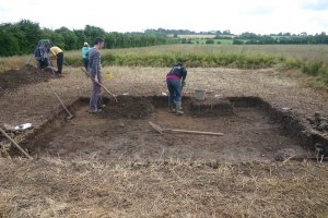
Having successfully taken all of the soil samples from the ploughsoil surface for later magnetic susceptibility analysis there was nothing further to delay actually getting stuck in and doing some digging. We set out each cutting – Cutting 6 in Area 1 and Cutting 7 in Area 2. We are continuing the trench numbering system from last year to avoid any overlay or confusion in the archive. Cutting 6 measures 10m x 3m and is orientated north-south while Cutting 7 measures 5m x 4m.
.
.
The ploughsoil in each cutting is being taken down first using mattocks and shovels and the spoil is being sieved for artefacts. This is being done on a metre-by-metre basis so there is spatial control on the artefacts retrieved. Although the ploughsoil is a disturbed context and a very dynamic layer, there could be a relationship between the material ‘floating’ in the ploughsoil and the features beneath it. We are recording the spatial locations of the artefacts anyway and hopefully in the final analysis patterns and relationships will emerge.
Geophysical Survey 2010
Following the surprise development in the excavation last year where it was conclusively established that the enclosures on the site are likely to be early medieval in date (and probably between 7th-11th century AD), it was decided to carry out further geophysical survey over the core area of the site on the top of the knoll within the tillage field. This was clearly a focus of activity in prehistoric times because of the extensive lithic (flint) scatter found there. It also seems to have been a focus during the early medieval period as this is the area central to all of the enclosures.
Because of the lithic scatter, this area remained the best candidate area for identifying prehistoric activity. However, because of the apparent intensity of activity in the early medieval period, there is a chance that any prehistoric features that may once have existed are completely destroyed and disturbed.
With these problems in mind, a second programme of geophysical survey was carried out in August 2010 at a higher resolution than the original geophysical surveys. The hope was to identify more clearly any features that might be earlier than the early medieval enclosures. Three high resloution surveys were carried out: magnetic gradiometry (Figure 1), earth resistance (Figure 2) and magnetic susceptibility (Figure 3). See the following figures for the results of each of these.
The magnetic gradiometry has shown up more detail than was apparent on the original survey. For example, the second enclosure from the outside clearly deviates from its curvilinear path as we move northwards towards the terrace slope. This may be a modification of an earlier version of the enclosure as there are hints of an earlier, less definite enclosure continuing northwards. The other feature of interest is the relationship between the inner complete oval enclosure and the D-shaped enclosure beneath it. The oval enclosure looks like it cuts through the other enclosure and thus is later in date. Furthermore, there is a difference in the quality of the magnetic response between the two features suggesting that they are constructed differently. The oval enclosure is more similar in the character of its response to the other, outer, enclosures. There seems to be a contrast between the innermost D-shaped enclosure and the rest of the enclosures, possibly suggesting different construction techniques which may be due to their being constructed at different dates. Clearly, the innermost D-shaped enclosure is earlier than the oval one. The question is how much earlier. Are we looking at a possible prehistoric enclosure?
The contrast between the different enclosures noticed in the magnetic gradiometry is replicated to some degree in the earth resistance plot in Figure 2 so what we are seeing is likely to be real and reflect the real character of the features themselves. The innermost D-shaped enclosure is almost invisible on this plot, especially along its western side. At the southern end of this inner enclosure feature there is an area of high resistance with a sharp delineation between the high-resistance (light coloured in the plot above) inner area and the low resistance area immediately outside (dark coloured). The junction between the two areas appears to be particularly sharp and suggests a possible stone facing/revetment feature.
The magnetic susceptibility plot shows an area where the soils have been strongly altered by activities like burning and the disposal of organic waste. It shows a clear and distinct focus of activity which seems to be contained to the west by the third enclosure from the edge. It extends a lot further to the south than the line of this ditch and continues on outside the survey area. There is a band of low values running in a north-south direction through the middle of the zone of enhancement which may be due to the way the space was utilised in the past, or it may be due to sampling or post-depositional processes. There seems to be a slightly separate elongated area of enhancement running east-west along the northern boundary of the field which may be a secondary activity focus. It may be significant that this is focused on the southern side of the highest point of the topographic knoll.
2010 Season Report
This interim report describes the work undertaken during the 2010 excavation season at Rossnaree Co. Meath. The excavation took place over a four-week period between Monday 5th July and Friday 30th July and targeted a series of topographical and geophysical anomalies identified in previous survey work. The site was first discovered as a dense scatter of lithic (chipped stone) artefacts systematically recovered from the surface of a tilled field during a major extensive surface collection undertaken some years previously in the Brú na Bóinne area (National Museum of Ireland collection number C97.2).
Subsequent multi-method geophysical survey funded by the Heritage Council and undertaken by Kevin Barton of Landscape and Geophysical Services revealed the presence of a large multi-vallate enclosure on the banks of the River Boyne which is roughly D-shaped and is bounded on the north and east sited by the River Boyne at the point where the famous ‘Bend of the Boyne’ begins. The enclosure cordons off an area of approximately 3.5 hectares and measures c.250m east-west by c. 150m north-south. This enclosure was reported to the Archaeological Survey of Ireland and an RMP number was subsequently issued (ME019-080—).
Excavation funding was granted for a dig in 2010 by the Royal Irish Academy Committee for Archaeology and four trenches in total were opened and excavated during the season. Two of these trenches focused on extant low bank-and-ditch features located to the north of the tillage field close to the riverbank. A third trench (Trench 4) examined the continuation of the line of the outer enclosure in the low floodplain to the east of the core area of the site and a fourth trench (Trench 5) investigated the area around a semi-buried greywacke slab close to the field boundary in the pasture field to the east of the core area of the site.
While flint flakes and tools were frequently recovered, the major features on the site, especially the bank feature in Trench 3, was dated to the early medieval period on the basis of the recovery of a double-sided bone or antler comb fragment. A fragment of a copper-alloy strap was also recovered from the same context. A fragment of a lignite bracelet was also recovered from topsoil in Trrench 5, also indicative of activity during the early medieval period.
The interim report may be downloaded in PDF format here. Rossnaree_Report_2010(lowres)
The 2011 Season is here!
It is now possible to announce that a second season of excavation will now take place at Rossnaree during the coming summer. It is probably safe to say that the dig last year was highly successful. Almost all of the objectives of the project were achieved, the most important of these being the retrieval of material suitable for dating the features at the site. Animal bone was recovered from stratigraphically perfect positions at the base of each of the ditches and in due course these will hopefully provide radiocarbon dates. However, during the excavation itself, we recovered artefacts which gave us a much quicker indication of the date of some of the ectivity carried out at the site in the past. A fragment of a double-sided bone comb indicated that the innermost bank (and probably the ditch too) was constructed sometime in the late first millennium AD. This represents an important addition to our knowledge of activity at this time in the Brú na Bóinne area.
However, the main research interest of the project is prehistoric, specifically settlement activity in the area during the time when the major prehistoric monuments in the area – the passage tombs and henges – were being built and used. We also still had to explain the major lithic scatter on the surface of the field which brought us to the Rossnaree site in the first place. This was deposited as a result of significant activity during the Neolithic period and it remains a distinct possibility that some of the anomalies identified in the initial geophysical surveys are Neolithic rather than early medieval. Because of this, we decided to have another look and this year we will be excavating in two areas within the ‘core’ area of the site on the top of the little knoll within the central enclosure.
A grant has been secured from the Royal Irish Academy Committee for Archaeology to fund the work and a group of volunteer students from Dundalk Institute of Technology and elsewhere have signed up to work on the site.
Day 20: The longest day
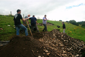
Once again, I am reduced to beginning a post by talking about the weather. Today was the last day of the dig and a lot of hard work lay in store for the small but elite group of diggers remaining on site. If desodding is regarded as an unpleasant job, backfilling is much more difficult and demoralising. To make matters worse, the weather was not kind to us today, making the job much more arduous. It started off drizzly, stopped for a while, started again, and so on until about three o’clock. Although we had completely backfilled Trench 4 already, there were still two, Trenches 1 and 3, to backfill. These were going to be tougher than 4 because they were situated on a slope.
Because of the topography immediately around these trenches, there was no option at the beginning of the excavation but to place the spoilheaps for each of them downslope of the trenches. This meant that every bucketful of spoil dug out of each of these trenches had to be shovelled into wheelbarrows and barrowed back uphill. At Trench 3, this meant that a zig-zag route was required, lengthening each journey across the slippery slope surface. In spite of the challenging conditions, we eventually reached our goal and completely filled the trench.
.
.
.
.
.
.
Then we moved on to Trench 4. A ‘closing deposit’ had been created on the top of the spoilheap by Clíodhna (age 6!), perhaps to appease the spirits of the place and atone for the disturbance that they had to endure over the previous four weeks. We worked until six, when we were fit to drop and a big thank you goes to all of the team who pitched in on this dreaded day lightening the workload with cheery conversation (and even some song!).
A big thank you goes to all who assisted with the excavation. Many people worked on the site over the few weeks, some longer than others. All time spent on the site helped and is greatly apprecated.
So to Matt, Kieran, Darren, Eimear, Niamh, Deirdre, Eamonn, Andrew, Valerie, Mark, Ailbhe, Michael, Gary, Jessica, Carol, Kim and Louise a very big thank-you. Thanks to Kevin and Mark for the surveying and the support and encouragement. To Paschal, thanks for facilitating our access to the field, to Fin and Steve for lending us the equipment we needed and helping with the logistics, to Niamh for the scones, to our visitors who took the time to come and see what was going on and also give their support, both moral and practical. And finally, to Aisling, many many thanks for allowing us access to one of the most enchanted corners of this island for the month.
Because the sitework is now finished, there will be no more day-by-day posts. However, we hope to do some additional ‘tidying up’ survey work soon in order to try to identify the presence of potential prehistoric features and I will post the progress and results of that work. Also, the post-excavation work will now commence, but as much of this will require additional funding which will hopefully be provided at a later stage, and there will be occasional posts on this as the work is done. Thanks to everyone who took the time to check out the blog; many of the comments came from people who are not known to me and who seem not to be archaeologists but who, nonetheless, found the blog interesting and informative.
Day 19: Best laid plans…
Our excitement today was watching the straw from an entire field being baled in a matter of a few hours by one guy on his own. I had never seen this machinery in operation up close. Mind you, he hadn’t ever seen an archaeological excavation up close either. A first for all concerned.
.
.
.
Kevin the geophysicist visited the site again today to take one last look at the remaining open trenches to see how well the excavated features match up with those recorded by the specialist geophysical equipment. There will be a very interesting comparison done at a later date and there may even be a few papers in geophysics journals reporting on the results of the test.
.
.
.
On site today the atmosphere was a little different to previous days. Everybody, I think, was conscious of the clock ticking and time running out. Most of the work of the day was directed towards recording and sampling, and there was very little actual digging done as most of this had been finished yesterday. There was still a little bit to do cleaning out Trench 1 and the small feature to the west of the big ditch.
We had thought for a while that this was a pit but as more excavation was done, it was clear that it was as predicted in the geophysical survey: an irregular linear ditch-like feature running downslope at a slight angle. We are still in the dark as to when this feature was created as there is no stratigraphic link between it and the other features in Trench 1. There was some flint out of it, but as we found out yesterday, this does not guarantee a Stone Age date – many items can be residual and redeposited in later times.
.
After this, the section drawings had to be completed in Trenches 1 and 3 and a plan had to be drawn in Trench 3. At the same time, we had to check that written descriptions of each of the features and layers (contexts) had been fully completed, and that samples had been taken. Lunch time came and went and despite being reminded of the time, everyone worked until each particular task was completed before walking up the hill to the cabin. Although hungry, everyone was absorbed in the work and was racing to get everything completed. When we did head up, we were able to walk through the barley field which is now stubble. We felt like the journey had been halved by our new route.
In Trench 1 Matt and Kieran completed their section drawing, Kieran assisted by Eimear. Matt took a closer look at the revetment feature at the east end of the trench and realised that it has some considerable depth. The stones are several courses deep (and continuing) and are set at an 80 degree angle and act as a facing to the steep bank, keeping it in place. Someone went to a lot of trouble to make this structure, and the clues we have suggest that there were many other such structures all over the slope.
I thought we would be in a position to make a start on backfilling one or other of these trenches today, but I had miscalculated the amount of work to be done. Tomorrow, we need to complete the sampling, much of which was done today, and add levels to the plan of Trench 1 before backfilling begins. Nobody is particularly looking forward to this – both spoil heaps are positioned downslope from the trenches meaning that there will be a lot of uphill barrowing to be done tomorrow. It looks like it will be a long day…
Day 17: The wind that shakes the barley
Weather report: There was a 2 minute shower of rain this morning at about 10am after which the day got steadily better with prolonged sunny spells during the afternoon. This really brought out the magic of the place for everyone toiling on site and reminded us how lucky we are to be working in this idyllic location for a while.
I was reminded today of the short-lived series that ran some years ago as a BBC answer to Time Team where archaeology in extremely dangerous and inaccessible places was filmed for our entertainment. Harvesting of the barley in the field beside us started this afternoon and we had a grandstand view of some of the drive-bys of the combine. An impressive machine.
On site work continued apace. In Trench 4 Kieran and Myself carried out a number of the sampling jobs I explained in yesterday’s post. The result of this was a trench resembling something from WWI because of the lumps we took out of the sides to fill various boxes, bags and buckets. All of the drawings of the trench had to be finished before this last step is carried out. All of this sample material will be carefully labeled and catalogued and put in storage until funding is available to carry out the post excavation analysis, which in the case of the soil samples will be carried out by trained specialists. Once this final job was completed, Kieran was able to start backfilling the trench.
In Trench 3 Matt, Darren, Jessica and Carol continued to take down the material from underneath the wall. This proved to be a bit thicker than expected because of the steepness of the slope underneath. At the eastern end of the trench, Matt took out the linear stone feature and beneath this another terrace face or revetment feature appeared. This will have to be planned and described before it is removed. Just when we were hoping that we would be close to natural and finishing up in the trench, another feature appears.
In Trench 1, Eimear, Kim, Niamh and Louise worked on the section face, which is now looking very good. This will be drawn again because it shows up more detail that was not appearing inn the section drawing done a couple of weeks ago when the ditch was first opened here. Louise continued to excavate the trench to the west of this to give a continuous excavated profile all along the southern end of the trench and she also discovered a new feature. It is a pit which we had originally thought was a shallow gully.
One set of geophysics suggested that this was a very shallow feature and when we dug the northern side of the trench we found that the feature was indeed shallow, barely 10cm deep. However, another set of geophysics was suggesting that there was some depth to the feature and this is exactly what Louise found just 50cm to the south. It just goes to show how much can be found (and not found) because of the positioning of the trenches in archaeological dig. A few centimetres in one direction or another can mean discovery or not of features. A lot is really down to luck.
The race will continue tomorrow when we’ll start to draw up the final records of the site.
Day 14: No drama today, just another day’s work
No thunder or lightning today, just one or two light showers of rain. No sun either and the day was a bit cooler than previous but nonetheless was quite pleasant.
Now with the weather report out of the way we can move on to the work done on site today. In Trench 4 (I always seem to start with this one, possibly because it is the nearest one to the site) Kieran drew a plan of the cutting showing the extent of the ditch, the slopes to the base on each side and the rest of the cutting. This view complements the section he drew yesterday – the section shows the side-view or elevation of all of the layers in the side of the trench while the plan view gives the bird’s-eye-view of the feature excavated. At the same time, I took a series of soil samples from the sides of the trench for magnetic susceptibility analysis. Samples had been taken previously at a higher level and readings have also been taken across the surface of the trench before the trench was desodded so we will end up with a very good record of how magnetic susceptibility varies with depth within the ditch. To remind readers, magnetic susceptibility measures the ability of the soil to become magnetised when a magnetic field is introduced and is a very good indicator of past burning or disposal of organic material like food waste or manure.
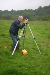
Both of these are of course closely related to settlement. The soil samples will have to be processed at a later stage after the excavation is over before the analysis takes place. They will be dried, sieved to remove stones and weighed to produce equal sized samples. In this way, we will be able to get accurate and directly comparable values for magnetic suceptibility. At the end of Kieran’s planning process, the final job to be carried out is to take levels of the area to give an impression of how undulating the planned surface is and to give a feeling for the relative depths of features. This is done on site with a simple dumpy level, which is being used in the photo by Chris who was visiting the site this morning. Chris was one of the geophysics team who first discovered and mapped the enclosure back in 2008 and he was anxious to see for himself how progress was going. In the photo, Kieran is holding the staff, which is like a giant ruler. He places this on each spot in the trench that he wants measured and Chris takes the reading through the level, which is like a small telescope that has been set up on the level. We know the height of the level in space (this has been established already) so we can calculate the heights of each point measured and recorded by Kieran on the plan.
In Trench 1 the work of the past number of days went on and Darren and Matt removed more of the dark, rich organic layer overlying the cobblestones making up the core of the bank. Lots more animal bone was found, some of which seems to have been burned (this will hopefully be confirmed by our animal bone specialist who is visiting next week). Some nice pieces of flint were also found including various flake fragments, a scraper fragment and a complete blade.
Beneath this layer the cobble stones were coming up very nicely and the site in this area at least was beginning to feel more than a little like an early medieval cashel. Because these date to between 500 and 1000AD, I wasn’t too happy with this idea! I still believe the site is Neolithic (4,000 to 2,500BC). I believe the staff have a book open on the date; one bet is that it is 850AD. Traitors! Seriously, no artefacts have been found that suggest that this site is anything other than prehistoric (and probably Neolithic) although, as I said before, some pottery would be very nice and would help remove any doubt. The cobbles in the wall do seem to have collapsed a bit over time; they are most intact at the bank end and less distinct moving eastwards away from the bank. There is also a lot of soil in between them which probably filtered down from above over the years too.
In Trench 1 more progress was made removing one of the ditch fills. Gary and Niamh cleaned up and exposed the layer of stones within this layer and, although at first glance they seem to have a pattern to them and appear to be part of a structure, this is completely coincidental. The excavators are certain that this just happens to be the way the stones settled after rolling or sliding down the slope from above, finally settling at the lowest part of the ditch. We will clean them a bit more and record them in plan anyway, just to be sure.
Day 13: Thunder and a skull
The day started out well in line with the Met Éireann predictions. However, the forecast was for deteriorating conditions with frequent heavy showers in the afternoon. It was looking like we were going to lose some time. However, it only rained once at lunch time but it was a very heavy and prolonged shower. Once it finished, despite being surrounded by slaty grey thundery clouds, it stayed dry.
In Trench 4 Kieran got stuck into recording the section. The process is to set up a baseline making sure that it is level. In the photo this is just below the edge of the trench and there is also a long measuring tape attached to it to help with the drawing. This is used to measure down to points to be recorded, e.g. the tops of layers, stones, the edges of a ditch. Each point is meticulously measured and plotted on a scale drawing so that there is a permanent accurate record of the material that has been dug through on an archaeological excavation. It is like a giant version of join-the-dots. Kieran was recording the various fills of the outer enclosure ditched as revealed in the side of Trench 4. Even with all of the modern technology that is available now, there is still nothing to beat the trained and experienced eye of an archaeologist, especially the person who has dug the particular trench. Some of the differences between layers are so slight and subtle that they are beyond the ability of machines to detect and must be drawn by hand. Even with all of the advances in digital photography it is still best to do this job the tried and tested way, even if it does seem slow.
In Trench 1 Niamh and Gary continued to take down ditch fill material, sampling as they go. A layer of stones has appeared and the base of one of the layers that hasn’t shown previously do the plan is to expose the stones to see if they form any pattern or whether they join with any of the other stony layers exposed in the section. Although they are likely to be material that has gradually slipped down the slope from higher up coming to rest in the upper fills of the enclosure ditch, tomorrow should reveal full their extent and allow us to decide properly why the stones are likely to be there. In the photo it is possible to see the clear difference in colour between the face of the bank and the ditch cut, both of which are stony and more grey in colour, and the fill material which is much more brown.
Very good progress was made in Trench 1 today because of the extra personnel there. Deirdre and Eimear took over sieving duties for Matt and Darren so that the digging cound take place continuously. Good finds were still being found through sieveing including the usual animal bone and flint. The animal bone assemblage is increasing in size and although we are only recovering fragments in most cases, we hope that analysis of the bone will be able to tell us about the economy of the site, i.e., what they were raising and eating.
The picture of what is happening in Trench 1 is changing rapidly as a result. It now seems that the point where the ditch met the bank was defined by large cobbles which were mentioned already. These cobbles seem to have served as a revetment or low wall keeping the core of the bank in place and they also seem to mark the edge of a layer of cobbles within the wall. These will be further revealed over the next day or two and hopefully it will become clearer to us as to what they were for.
Towards the end of the day, however, another interesting find was made. A theme has been developing over the last few weeks that we’ve been finding cattle bones in significant places in the excavation today’s find was yet another example of this trend. Set on top of (or possibly within) the cobbles on the bank in Trench 1, what appears to be a cow’s skull began to be revealed. This may just be rubbish thrown out from higher up in the site but at the moment it appears to have been perhaps deliberately placed within the material in the bank of the inner enclosure. Is there a real theme developing in this site? Are cattle somehow important to what the site was used for? Hopefully we’ll have some answers before long.
Day 10: Half way! ‘A lot done, a lot more to do…’
We are now at the end of our second week; day 10 out of a total of 20. Am I a glass-half-full or glass-half-empty person? I think that the rate of progress has slowed a bit in Week 2 relative to week 1 but this was inevitable. We had a larger crew in Week 1 and a lot of material was moved – desodding and topsoil. The nature of what we are dealing with now means the work now has to take a slower pace. We are trowelling a lot more rather than mattocking and shovelling. We also have to stop digging at intervals in order to record the features we uncover. However, there have been important successes. Nothing that has been found so far on site suggests that the enclosure is anything other than Neolithic in date. Although there has been no pottery yet (which is closely dateable because of their fast-changing shapes and decorative styles over time), there has been a lot of flint pointing to prehistoric and probably Neolithic or Early Bronze Age construction and occupation.
Anyway, the news for today is that first of all, the weather turned out much better than we were expecting. After the near wash-out on Thursday we had been expecting blustery showers all day. The wind didn’t materialise and there was no rain at all. As a result we managed to get some more work done. The success of the day was that in Trench 4, Kieran and Deirdre were really getting to grips with the nature of the enclosure ditch. The edges had been clearly established and they began to take down the fill. Although the ditch was not bottomed we are definitely in the right place and the base is not far off. Digging finished up at a level characterised by a layer of field stones which must have spilled in from one side or the other. The fact that they are so deep down in the fill suggests that this event may have taken place relatively early in the life of the ditch. This layer may be comparable to the ‘spill/slump’ layers of stones identified in Trenches 1 and 3 and the stones may have come from a bank feature that once would have stood along the inner edge of the Trench 4 ditch. There is no sign of such a bank today in any of the data we have – aerial photographs, LiDAR, and the various geophysical outputs – but it is likely that there once was one in this area comprised of the spoil dug from the ditch. There are very few finds from this part of the site; although they are there the numbers are extremely small compared to Trench 1 and especially Trench 3 close to the core of the site. Perhaps there wasn’t much activity in this part of the site. Even today, this is an area subjected to regular flooding during winter and would have been the same in the past. It would not have been a wise location to construct houses or other structures. Perhaps the stony layer so far down in the section suggests that there was less concern in maintaining this part of the site compared to the sections of ditch in Trenches 1 and 3. The fill of the ditch looks promising for the preservation of macrofossil plant remains and perhaps pollen. Snail shells were also noted in the fill here and soil samples will be taken to examine the specific species present as snails (molluscs) are very sensitive indicators of the environmental conditions in an area in the past.
Work also continued in Trench 3 where Matt and Darren continued to explore the fills of the ditch there. We had been speculating as to the probable depth of the ditch here. One set of geophysical data was suggesting that it was not as substantial as the outer enclosure ditch encountered in Trench 1 while another set of data was saying that it was comparable in size. I had thought that it may be less substantial as it was an inner enclosure but the digging here today suggests that it may be as big as the Trench 1 ditch. A considerable depth has already been reached and the signs are that it is still going down. More to be revealed as we continue early next week.
We also had a number of visitors to the site today: Gabriel, Steve, Aimée, Kim and Emmet from U.C.D. as well as Bryn who is visiting home from Australia and Michael who helped out on site in the first week of the dig. They reminded us once again of what a wonderful place we are working in. I think we may have begun to take our surroundings a bit for granted, and of course the weather wasn’t helping.
Regarding the question posed at the top of this post, I think I have to say that the glass is definitely half full. Maybe even more…
Day 9: Soft day, thank God
We Irish have a ludicrous saying suggesting that we actually like the auld bit o’ rain now and then. Today might have qualified for the ‘soft day’ categorisation but there’s no way any of us on site were particularly pleased with it today. There were numerous heavy showers but the weather couldn’t make up its mind as to whether it was coming or going. The result was a lot of wettings and some very stop-start work. Anyway, the one good thing about the weather today was that some of our crew were not able to make it to site today because of other commitments. So not everybody had to be subjected to a soaking!
The work that we did manage to get done was limited but it nonetheless pushes us a little further towards our ultimate goal. In Trench 4, Kieran, Eamonn and Deirdre continued to peel the cultivation sol off the top of the fill of the enclosure ditch. Very few finds were coming out of the material being removed but Deirdre’s sharp eyes picked out a fragment of a rock crystal flake (sorry no photo). This is very small-less than half the size of your little fingernail-but is distinctive and unusual. Although more difficult to work into tools than flint (and harder for us archaeologists to recognise) it is clear that materials other than flint were often used by people in the Neolithic. In some cases it seems simply that where there was a shortage of good quality flint, people used other materials like chert and quartz as ‘second best’ alternatives. However, it is also possible that the materials chosen for toolmaking reflected the intended functions of the tools or reflected the identities of the people making the tools. We all have the good crockery at home for when visitors call. Similarly, craftspeople today often use unusual or distinctive materials as a sort of trademark. Perhaps this was going on in the Neolithic as well. The flake fragment we found is distinctive because it is a type of quartz which is almost transparent, like glass. This quality would not have been lost on the Neolithic people.
In Trench 1 we continued to take out the fill of the gully and we also drew the north-facing section exposed when we excavated the enclosure ditch. We also plotted the locations of the magnetic susceptibility soil samples we took yesterday. We managed to complete these various jobs by lunchtime between showers and then we transferred over to Trench 3 where there is also a bank and ditch feature. The plan was to start to take down the material filling the ditch in the same was as in Trench 1. We unfortunately didn’t get much done because of the rain but we did notice a larger number of bone fragments compared to Trench 1, reflecting the position of Trench 1 closer to the ‘core’ of the site.
Can’t decide whether the weather forecast was accurate; I think it was today. A blustery day is forecast tomorrow with scattered passing showers. I think we may be able to cope with that.
Day 7: ‘Now you’re sucking diesel’
The weatherman had warned of rain spreading into Munster and south Leinster by midday spreading to all areas over the afternoon so we were apprehensive about when this weather would actually arrive. The day was not as bright and as sunny but was still dry. The big news for the day was that we were joined by reinforcements in the form of Deirdre, a veteran of many previous excavations including Graeme Warren’s dig at Belderrig and Geraldine and Matt Stout’s dig at Site M, Knowth. A valuable addition to our small team.
Work focused on two areas today: Deirdre and Eamonn under Kieran’s supervision began to work down through the topsoil/cultivation soil in Trench 4, the site of the geophysical survey work on Saturday. Ultimately, the excavation of this trench will be a test of the accuracy of the various techniques we used during that survey.
The other area of activity was in Trench 1, continuing the explorations started yesterday tracing the extent of the ditch of the outer enclosure. Work went very well and by lunchtime, Matt had found the bottom of the ditch and by the end of the day he had found the sides of it as well, at least on one side.
The ditch turned out to be around 90cm deep, pretty much the depth indicated in the ERT section carried out over this area some time before. This is a very good result for us excavating the site, but also for Kevin, who has hard evidence to show how well the equipment works.
As if that wasn’t enough, out of the very base of the ditch, at 4.40pm, almost when the day was done and it was time to pack up to go home, Matt made another discovery. At the very base of the ditch, he uncovered an intact cow’s mandible. You may wonder why you should be excited about this. Granted, it is not the most exciting find and you’re highly unlikely to find one of these in any museum display. The main value of this find is that it can be scientifically dated using radiocarbon dating and an independent scientific date for the site can be established. It was in the perfect location for establishing an accurate date; right at the bottom of the ditch. This means that the bone must have made its way into the ditch very soon after the ditch was dug, presumably while the site was in use. If the bone was further up in the fill of the ditch, it could have made its way into the ditch some time later and thus would not be a reliable indicator of the earliest use of the site.
Furthermore, it seems that the bone may have been deliberately placed at the base of the ditch because it was found in a small ‘slot’ feature right at the base. This would further connect the bone to the initial digging of the ditch and the earliest use of the site.
It seems inevitable that there will be some rain over the next couple of days. Hopefully not too much!
Day 6: The glorious twelfth…
And it was certainly a glorious day today on the banks of the Boyne. A welcome change from the persistent rain of Saturday and the torrential showers of Sunday. Very worrying for the coming week. It was a quiet day on site today because of the departure of three of the team at the end of last week. We are expecting some new blood tomorrow all going well and they will be very welcome.
Today, the main focus was in Trench 1 on the slope of the gravel terrace on the northern side of the site. Having exposed and recorded the surface of archaeological layers by the end of last week, we now took a closer look at the separate components within this surface (see Day 4 blog). We had to determine which layer we should excavate next. There are two banks in Trench 1 and on either side of these banks there appears to be a layer of larger stones in a position that suggests that they may have slipped downwards off the bank itself. This material is likely to be lying on top of the junction between the ditch (fosse) and bank. The ditch, although visible on the surface as a dip in the ground surface, is not open to its full depth because in the years since it was dug various processes have been at work filling it back in again. Rainwater washes clay and soil downslope from the banks which settles in the low ground of the ditch. Sometimes stones roll down the slope into the ditch as well. Animals walking over and back over the banks wear them down and encourage movement of material into the ditches. Very often when sites were lived in, ditches were used as convenient landfill sites so a lot of food and other waste made its way into them. Thus the soils of ditches are often looser than the soils around them, they often are less stony and often have organic domestic waste in them, including charcoal, which makes them different to the soils of other features around them. While we have identified an area where the material is very likely to be ditch fill, we are currently trying to find the extent of this material, i.e., where are the edges. This is tricky because of the large amount of smaller stones in the soils and also because the soils are so similar in colour. However, we are confident that we will resolve this before long. There are still finds including flint and animal bone coming out of the soil we are digging so we know that it is fill; these materials could not have found their way into undisturbed natural soil.
Lots more to be done tomorrow. Hope the rain holds off.


